
The Chichen Itza Street View “Tourist” With the Too-Big Head
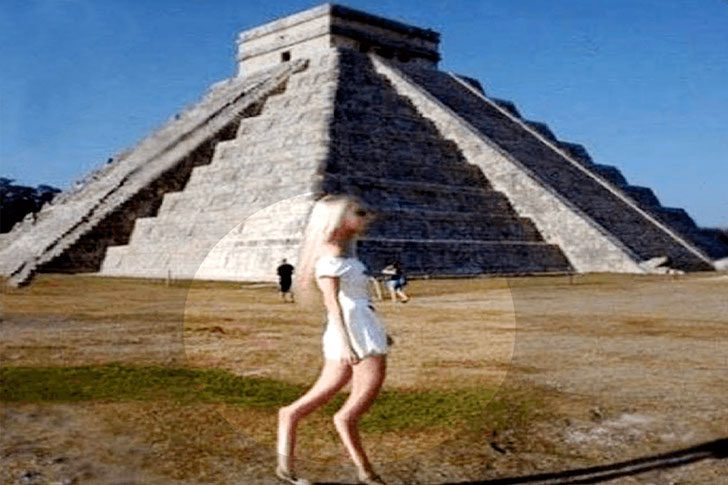
Google Maps Street View often helps find coffee shops or check parking, but sometimes it reveals bizarre snapshots. Among Chichen Itza's ancient ruins in Mexico, one of these oddities appears: a blonde visitor walks through like it's just another sunny day. Nothing seems amiss, yet the scene prompts a "wait, what am I looking at" reaction, drawing viewers to zoom in.
On closer inspection, it gets stranger. Her straight hair, short white dress, flat shoes, and sunglasses suggest an ordinary tourist. Yet, her head appears disproportionately large for her slim body, creating a visual dissonance. While some attribute it to camera distortion or stitching errors, others jest that she seems too unearthly for a standard sightseeing excursion.
The One Giant Carved Into Chile’s Desert That’ll Make You Do a Double Take
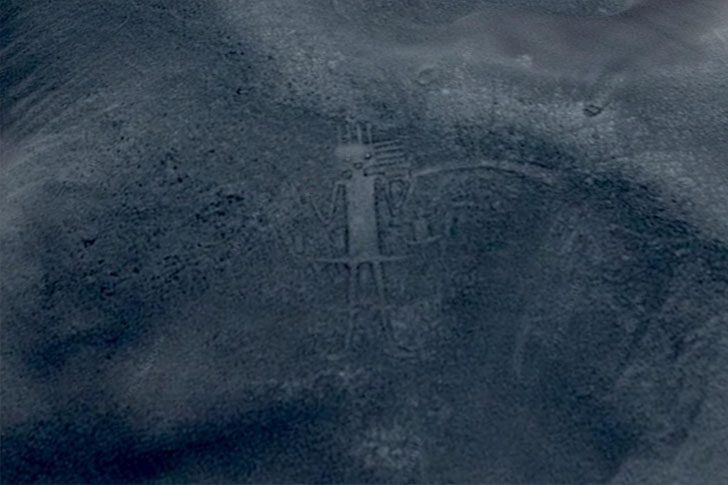
For ages, massive land art has been blamed on aliens. Spotting a huge figure in the earth can lead to, “Yep, that’s an extraterrestrial self-portrait.” This desert doodle, a true giant, is near Huara, Chile. Whether friendly or not, it has an uncanny vibe, leaving a lasting impression, especially if you’re prone to weird dreams.
Probably not a message from space, the mystery lies in who created it or its purpose. The intrigue is real; it’s so large you can see it in Google Earth views. Clearly, it wasn’t a quick project. Someone dedicated serious time, carving and shaping the ground until the figure emerged at desert-sized scale.
This One Google Street View Spot Is Basically a Lava Lake Up Close
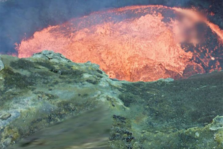
Vanuatu’s Ambrym volcano is not known for “subtle.” Famous for eruptions and bubbling lava lakes, it's a spectacle Google wanted to capture. The tech giant aimed to bring this remote, wild scene to viewers without the need for travel, capturing the intense natural beauty that defines this isolated landscape.
LiveScience mentions explorers equipped with 360-degree cameras were instructed, “Go get the shot.” They approached the rim of the lake to record the scene, allowing us to experience it via Street View. It’s the closest one can get to the glowing lava without visiting. For scale, compare it to a standard satellite view, and the vastness of the pools becomes apparent.
The One Masked Photo From Sonora That’ll Make You Double-Take
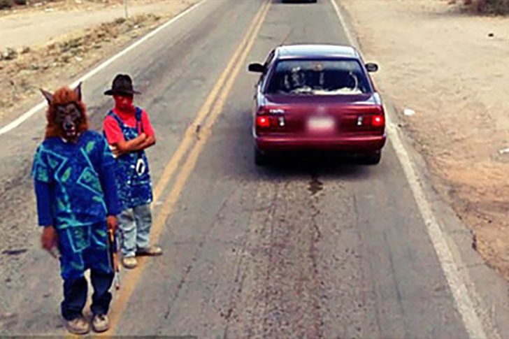
This photo was snapped in Sonora, northwest Mexico, and looks like it came from a low-budget horror film. No one expects a group of masked individuals, one resembling a Scream character, plus a werewolf with bold opinions about patterns, to hang around an area once notorious for the ruthless Los Zetas. The scene seems “staged,” as if someone yelled “action” but forgot “cut.”
What are we looking at? It could be Furries lost on their way to a convention, or something darker. There's little middle ground. Joining the Furry community should mean choosing a mask that screams “fun,” not “true crime documentary.” The outfits are memorable but not comfortingly so.
The Café Chair That Made Everyone Do a Double Take
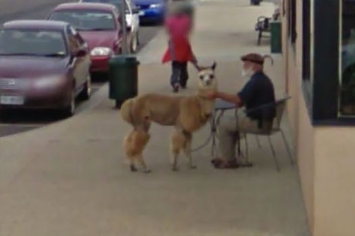
Clicking around maps has led to many “wait, what?” moments, and Sheffield, Tasmania, offered a striking one. A street photo shows a typical sunny day: shoppers on sidewalks, visitors passing stores, truly routine. But right outside the café, something eye-catching unfolds.
A man lounges in a café chair, seemingly enjoying his snack and the afternoon. All seems ordinary until his “company” is noticed—a not-so-typical patio buddy. People often see dogs and cats as prime pets, yet an alpaca close enough for a cuddle presents an unexpectedly warm alternative.
Why This VW Bus Is Glowing for All the Wrong Reasons
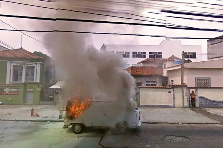
Heraclitus had a point: the universe loves change. Usually that means seasons, hairstyles, or phone updates you did not ask for. Here, it means a VW bus actively turning into a smoky pile of carbon, one crackle at a time. Honestly, the shirtless guy on the left deserves a slow clap. While the van does its best impression of a bonfire, he stands there like this is just another Tuesday, calm as a statue.
Ever look at your car and think, wow, this thing is basically a rolling trash can? Congrats, you are still doing better than this. This ride has seen better days. Sure, it's bright, but in a “call the fire department” way. And yes, it is hot, but not in the charming, heartthrob sense, more like the guy down the street pushing his awful mixtape on everyone at the block party.
Why This One Cleveland House Still Shows Up Blurred
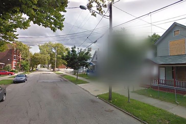
Stick a super high-definition camera on top of a Google Maps car and send it cruising down city streets, and you're going to capture some truly weird moments. A lot of it is harmless, like people waving or doing something goofy. But sometimes, the footage enters disturbing territory, enough to get scrubbed or blurred. A strange blur zone sits on a working-class block in Cleveland, Ohio, tied to Ariel’s former home.
For nearly a decade, three women were held captive inside that house. The actor even fathered children with them, until one of the victims escaped and got help. After his arrest, he died by suicide in prison. The building has been torn down, yet the area still appears blurred on maps, as if the street is trying to forget what happened there.
The One Haunting Detail Still Visible in the Costa Concordia Wreck
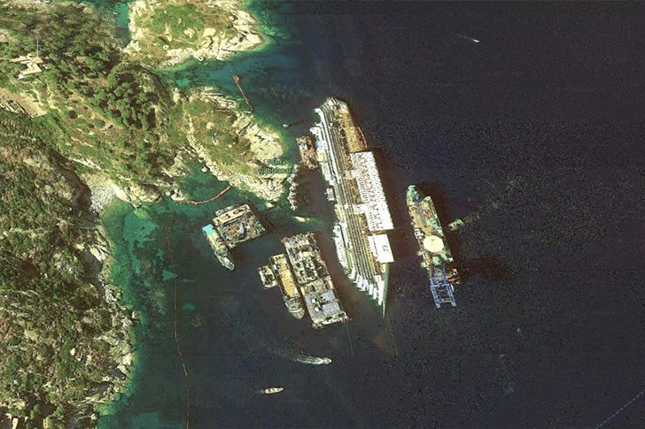
In 2012, the Concordia ended up half-submerged off Italy after striking a rock near Isola del Giglio, off the Tuscan coast. This photo captures the salvage operation where crews strove to stabilize and recover what they could. Even from above, it looks unsettling, as if the ship is frozen mid-disaster. It's haunting not because it's dramatic but because it's quietly real—a reminder of how swiftly a routine cruise can turn catastrophic.
Years later, the disaster's legacy persists. The debris was taken to Genoa, dismantled, and scrapped. The twisted, rust-stained hull stands as a stark reminder of Italy’s worst maritime disaster since World War II. The ship may no longer rest in the water, but its remains endure, symbolizing that fateful night when everything went awry.
Why Is There a Giant Lion Etched Into an English Hillside?
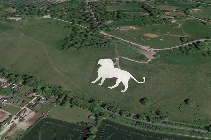
People using Google Earth have discovered something straight out of a storybook: a huge lion carved into a chalk hillside. Locals have known about this giant feline for ages, but satellite views have made it an internet celebrity, with many calling it “The Lion King.” The big cat sits out in the open near Dunstable, UK, as if guarding the fields and waiting for someone to zoom in and notice.
According to BBC, it stretches about 483 feet from nose to tail, making it the largest hill figure in England. It faces the Dunstable Downs and is often said to be pointing toward Whipsnade Zoo in Bedfordshire. The original idea was practical: it serves as a warning for low-flying aircraft, a heads-up that the zoo is coming up so pilots wouldn’t roar overhead and spook the animals. Not bad for hillside art.
The One Google Street View Shot That Looks Like a Pigeon Cult
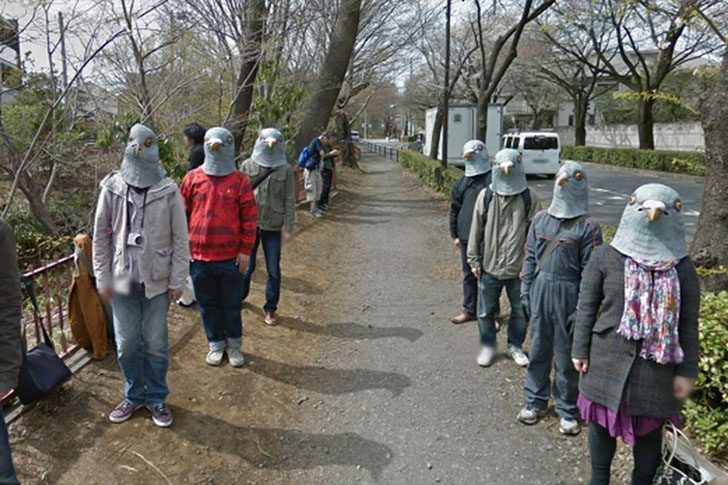
Google Street View captured a scene in Japan that seems straight out of a sci-fi film: a group of “pigeon people” staring into the camera. This unsettling photo shows eight figures, expressionless and frozen. The image quickly gained attention online.
Pigeon role-play is common in Japan, but it doesn't make this sight any less eerie. In July 2013, Reddit user bawsinmymouth shared the Musashino, Japan location, sparking curiosity. The setting is ordinary—a serene trail—until bird humans suddenly appear. It’s bizarre, funny, and perfect for going viral.
The One Thing in This Street View Shot That Makes Your Stomach Drop

We’ve said it before: Google Maps cars capture some of the wildest moments on ordinary streets. Sending camera rigs everywhere allows us to “travel” from our couch but also reveals shocking, scary, or darkly funny scenarios frozen in a click. Usually, it’s just houses and intersections. Then, suddenly, it’s something extraordinary.
This image shows a real car crash caught mid-moment by a Street View vehicle as it passed by. No staging, no dramatic setup, just unfortunate timing and a constantly working camera. Late in 2019, Google shared numbers revealing their massive operation, making it inevitable that moments like this would occasionally be captured in their snapshots.
What Happens to Grass When a Fighter Jet Lights Up Its Engines?
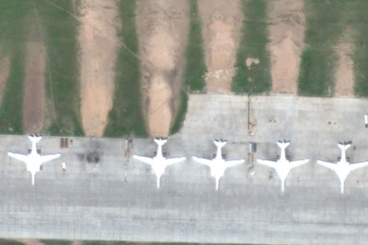
Be nowhere near the business end of these jets. This image reveals how brutal their engines are: grass isn’t just flattened; it’s blasted. Bare patches mark ground scoured by exhaust, which is insanely hot and fast. It’s a heat-soaked blast turning green into a worn-out mess.
Jets are powerful, but seeing this hits differently. Engines push force backward, launching aircraft forward, while the ground suffers. In the photo, you can trace the damage, like a blowtorch met a sandblaster. Those green sections have seen better days and won’t recover soon.
This One Google Maps “Alien” in Nancy Has a Much Weirder Backstory Than You’d Guess
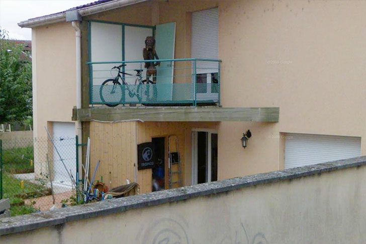
Take a casual spin through Nancy, France, on Google Maps and you might do a double take. Perched on a terrace is a creepy humanoid figure with big, pale eyes and wiry hair, standing like it’s waiting to be noticed. People grabbed screenshots, shared the location, and it blew up online. Soon after, Google blurred the house, making it feel even more ominous.
Before you draft a “proof of aliens” thread, there’s a grounded explanation. That scruffy silhouette is likely just a tiki statue catching the light in a scary way on low-res street view. Still, paranormal fans poke holes in the sensible answer, insisting something stranger is happening. Maybe the statue wanted privacy, or the homeowner didn’t love random visitors asking about the “Tiki Demon” on the balcony.
The One Lake Near Baghdad That Looks Like a Pool of Blood
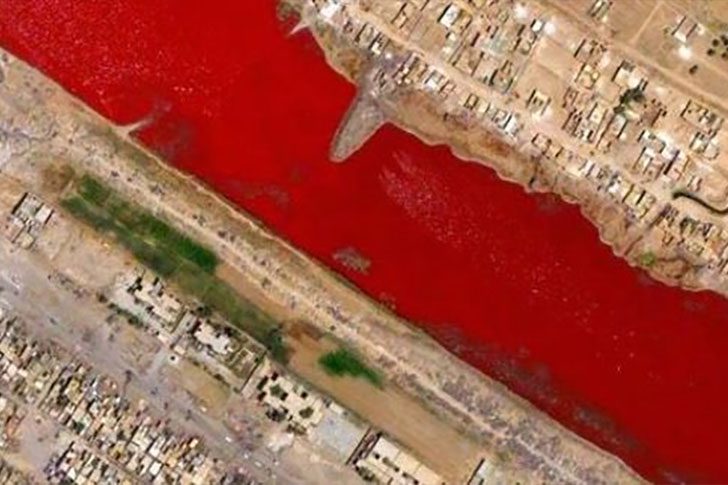
Just outside Sadr City in Iraq, there’s a lake turning an unsettling shade of blood red. No official explanation exists, drawing attention since 2007. The internet buzzed with theories. One source claimed that local slaughterhouses dumped blood into nearby canals. Such rumors stuck due to the lake's striking color.
The more plausible answer is scientific. In warm, salty water, specific algae and bacteria thrive, producing reddish pigments. With the right mix of heat and salt, a lake becomes a petri dish, shifting from normal to crimson. Until studied, the eerie look will spark speculation, but biology likely explains the red hue.
The Desert Lot Where Thousands of Airplanes End Up
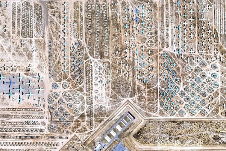
Ever wonder what happens to airplanes when they’re done flying, not just “retired” in a press release? Curious Google Earth users discovered the answer at Davis-Monthan Air Force Base near Tucson, Arizona. This massive aircraft boneyard is the largest on the planet, where U.S. military planes go when their missions are over.
Established after World War II, the site benefits from Tucson's dry climate, which slows corrosion and preserves aircraft. Some planes remain intact, while others are dismantled for parts to keep other aircraft operational. The vast, orderly rows look like a parking lot for giants. Interested viewers can visit via available bus tours.
Why This Japanese Yard Is Packed With Seated “Neighbors” That Aren’t Real
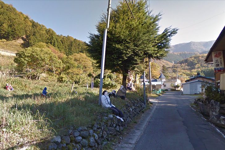
Google Earth once captured a yard in Nagoro, Japan, appearing to host a peaceful gathering. Initially, it seems like locals are relaxing, possibly waiting for tea. Zooming in, the illusion breaks; these "locals" are oversized dolls. Rather than a bustling scene, the yard is filled with scarecrows posed as if they've always belonged, occupying benches, porches, and corners.
According to NPR, the person behind this eerie gathering is Tsukimi, creating scarecrows for over a decade. She started crafting them to fill the void left by Nagoro’s dwindling population. Some figures are based on familiar figures, while others are quiet tributes to departed neighbors. The creation serves as art, memory-keeping, and an optical trick, giving the village life again.
The One Google Maps “Hill” That Looks Like a Vertical Drop
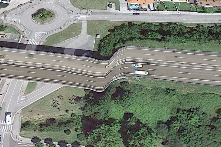
This road hugs the Oria River in Orio, a small tourist spot where the river meets the sea. It's near the harbor and has caused concern, not because the pavement turns into a ski jump. What appears as a straight-down slope is actually a mapping glitch in Orio, Spain, during Google’s imagery processing. The platform has sparked traffic jams before, with this being another case.
It's a relief this is just a software hiccup and not a driving hazard. Still, imagining the chaos of an actual road drop is amusing, particularly on a busy route. Drivers would slow down to stare, and the brave (or clueless) might attempt it as a stunt. A “hill” that steep on a main road would indeed spell disaster.
What’s That Two-Legged “Dog” Doing on Google Earth?
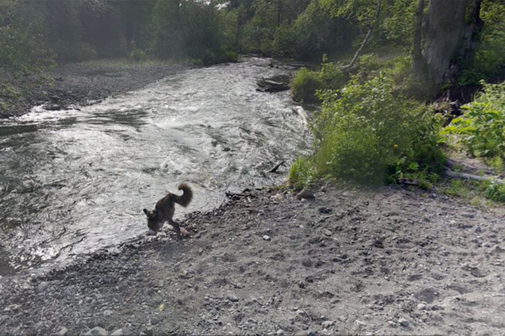
We want to believe there’s a mysterious dog-wolf mashup out there casually strolling on two legs. But let’s be real, this looks more like Google Earth having a meltdown. Rose stumbled on the screenshot, and it’s hilarious. The image dates back to June 2016, pinned to Far North Bicentennial Park on Google Earth, making it feel more official than it deserves.
If you zoom in just the right amount on those user-uploaded 3D photos, the scene starts to warp into something less “park stroll” and more “surreal art project.” It’s the kind of distortion Salvador Dalí would nod at, like, “Yep, that tracks.” Now the big question is whether the real owner of this glitchy-looking pup will ever spot their accidental internet fame.
The One Island on Google Earth That Still Gives People the Creeps
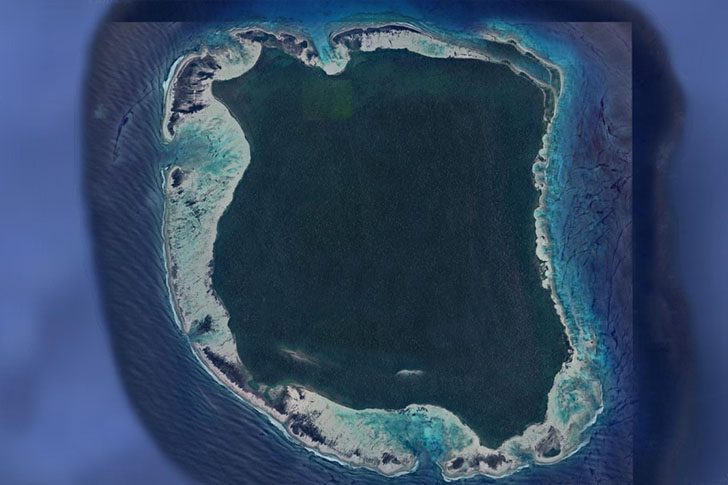
At first glance, North Sentinel looks like a regular green blot in the ocean, all thick jungle and sandy edges. It is home to one of the last uncontacted peoples on Earth. No roads, docks, or visible signs of modern life exist, just forest pressed right up to the shoreline. Reports often compare its size to Manhattan, yet it has never opened itself up to the outside world.
We barely know anything about the place or its residents. What we do know is from brief encounters; they have a reputation for making it clear they want outsiders gone. Over time, that defensiveness has only hardened. For now, we have distant satellite snapshots and unanswered questions, which is why the island feels so eerie.
The Tiny Antarctic Hut That Time Forgot
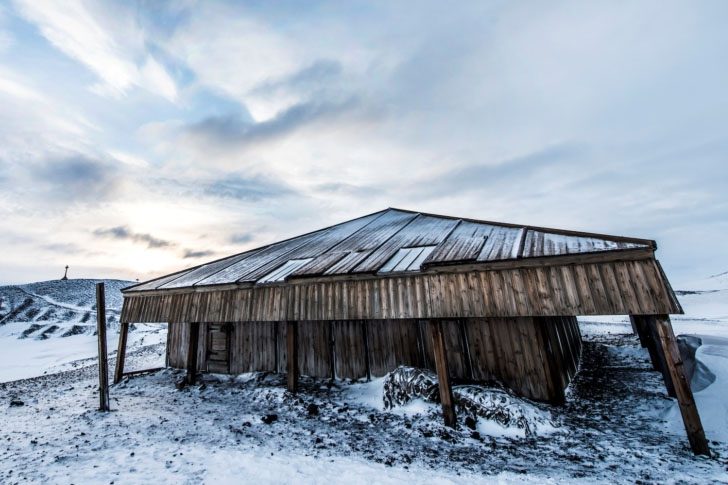
The small wooden shelter on the north coast of Cape Evans on Ross Island, Antarctica, built in 1911, served as the base for the British Antarctic Expedition from 1910 to 1913, led by Robert Falcon Scott. Intended as a practical headquarters, it astonishingly survives to the present day, enduring harsh polar winds while remaining uninhabited yet rich with history.
To preserve it, New Zealand’s Antarctic Heritage Trust has stabilized the structure, repairing damage and sealing it against the weather. This has safeguarded 18,202 artifacts left inside, including clothing and food supplies, ensuring the hut remains a historical time capsule. For those unable to visit, a virtual tour on Google Earth offers an immersive experience.
The One Thing You Can Still Peek Inside on Google Earth, Scott’s Hut

Google Earth doesn’t usually let you snoop inside buildings, but occasionally it allows exceptions like Scott’s dwelling. You can take a virtual look around the interior, as if stepping through the doorway yourself. What's striking is the meticulous upkeep. Sites like this and Shackleton’s shelter, once vital for early Antarctic explorers, feel more like time capsules than ruins, welcoming you inside.
The hut contains expedition supplies, including food, medicine, and gear, remarkably preserved after more than a century. Sitting empty for decades, it looks nearly untouched, as if its occupants simply walked out. This preserved, timeless atmosphere is both fascinating and eerie. It’s not just a building; it’s a glimpse into the lives of those who braved the harshest continent.
The Guitar-Shaped Forest Hidden in Argentina, and the Love Story Behind It
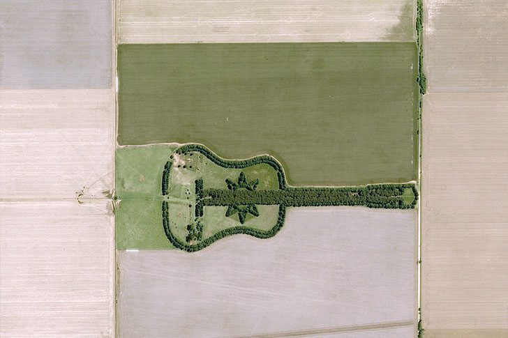
Drive through Argentina’s farmland and you might spot something surprising, a forest laid out like a giant guitar. It’s not a trick or legend. A farmer named Pedro Martin Ureta designed and planted it, turning flat countryside into living artwork. The forest stretches nearly two-thirds of a mile, constructed from over 7,000 trees, mostly cypress and eucalyptus, arranged precisely.
The reason behind its creation is deeply moving. To honor the memory of his wife, Graciela Yraizoz, Ureta undertook this project with his four children, planting every tree by hand. Initially a private act of devotion, it has become a landmark for travelers, a spontaneous stop for many. It’s a rare sight, unique in its design, and visible even from miles above, thanks to Google Earth.
Why Is There a Massive Pink Bunny Sprawled on an Italian Hillside?
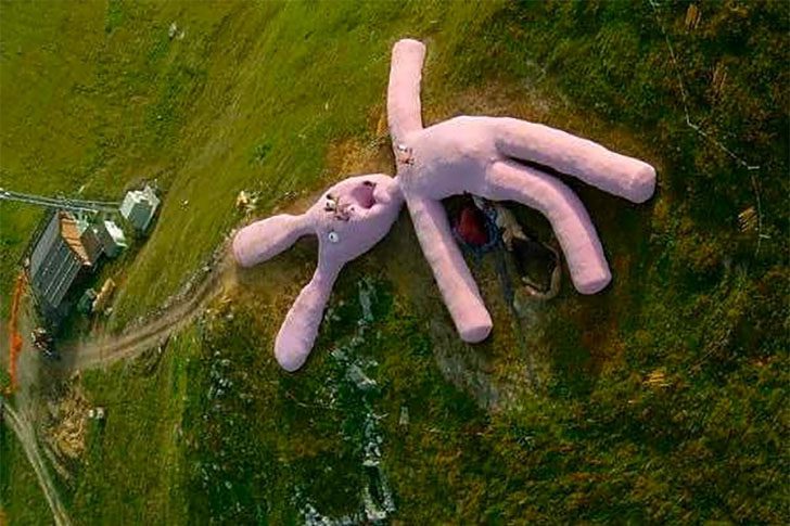
This odd sight comes from a Google Earth view of Artesina in Piedmont, Italy. The culprit is Gelitin, a Vienna-based art collective that decided the world needed a crocheted bunny visible from the sky. Built in 2005, it was stitched together using mostly straw and wool. About a tonne of wool composed its “skin,” crafted by hundreds of older women over roughly five years.
Hiking in the area, encountering this gigantic, slightly eerie rabbit can be startling, which is the point. The sculpture was meant to be interacted with, not fenced off. Visitors are encouraged to climb on and lounge on it. Gelitin planned for it to decompose naturally, embracing decay from day one.
That One Google Earth Snapshot That Caught a Biker’s Perfect Victory Pose
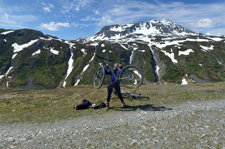
Out in Alaska, you can hike, pedal, or paddle for hours, feeling like the state's all yours for the afternoon. With fewer people than New York City, the wilderness engulfs you. This Google Earth moment is a delightful surprise: an unnamed rider, traversing icy, rugged mountains, captured mid-ride in a triumphant pose with her bike.
Zoom out and you'll see her with a small crew, enhancing the scene. It's tempting to wonder if she saw the camera car and thought, "This is my moment," lifting her bike for a victory shot. Regardless, the timing is flawless. They were biking near Seward, Alaska, in June 2017. Thanks to that drive-by camera, their adventure got a little bit immortalized.
Why This Car Looks Like It’s Driving on a River, and the Guardrails Give It Away
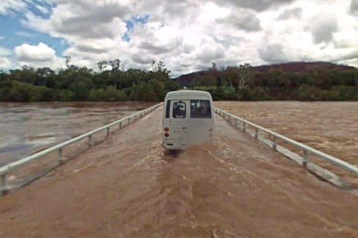
Rolling through Delamere, a Google Earth staffer encountered a scene that makes you do a double take. Delamere, in Australia’s Northern Territory, had been hit with flooding, making a vehicle appear as if it’s cruising across a river. Then comes the giveaway: side guardrails. That’s no boat launch but a road submerged under water. In such moments, the landscape doesn’t just shift; it completely alters driving norms.
This isn't the first time the area has been flooded. In 2018, a monsoon caused major flooding, stranding people and requiring rescues from trapped cars. Floodwater is perilous, as one wrong move can turn a mundane drive into an unexpected “river tour.” When water blankets the pavement, assessing depth and current becomes nearly impossible until it’s too late.
The One Thing Hanging Over This Greek Cliffside Restaurant
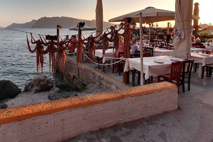
We’re a little jealous of this moment Google Earth caught a few years back. Oia, on Santorini, is tiny but knows how to show off. Everyone talks about the sunsets, but sunrise here can be equally stunning. Homes and restaurants are tucked into alcoves carved into the seaward side of the crater, stacked along the caldera’s steep slope.
Cave homes cut into volcanic rock are famous here. Oia is all about beaches, endless blue water, and seafood that tastes like it was pulled from the waves minutes ago. The standout detail: a lineup of octopi hanging out to dry, essentially advertising dinner directly. Looks like tonight’s special is already on display.
Why Are There Giant Bunny Suits in This Coffee Shop Photo?
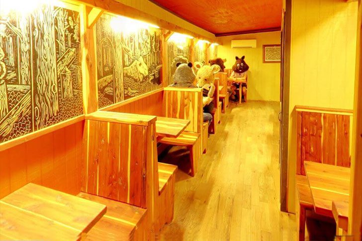
Need a spot to kick back with friends, grab a drink, and dress like a woodland creature? Buzz Mill in Austin has you covered. This Google Earth screenshot makes you squint, laugh, then wonder if you should be worried. The scene is from a well-known coffee shop that's usually relaxed, rustic, and normal, until you start poking around the virtual tour.
Google Earth lets you wander inside, appearing like any other cozy cafe. Then, drift toward the gaming area—surprise! People are in full animal costumes like it's normal. The wild part is you don’t see them right away; swivel around and explore before the costumed guests pop into view, sipping coffee like this happens every day.
The One Island That Looks Like a Battleship, and Why Nobody Lives There
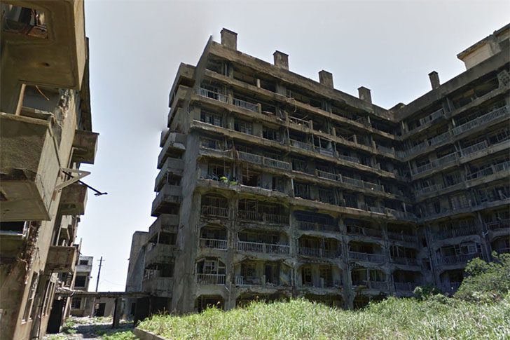
Hashima Island, or Gunkanjima, off Nagasaki, resembles a city frozen in time. From the late 1800s, it thrived as a coal-mining hub, supporting 5,000 residents with apartments and services. As coal lost its appeal, the mines closed, and by the 1970s, everyone left. Though deserted for decades, the site opened to tourists in 2009.
Thanks to Google, people can explore without a boat, accessing 360° views that mirror its eerie, paused essence. Their Trekker imagery reveals areas off-limits to tourists, showcasing remnants like old TVs and soda bottles. The island blends history with silence, like it's still awaiting the next shift change.
The Weird “Space Gear” on Mauna Kea’s Summit, What You’re Actually Looking At

Barely recognizable as Hawaii, this summit rises 13,802 feet above sea level, marking the highest point in the state and one of Earth's tallest island peaks. The dome-like structures are the Mauna Kea Observatories, essential for research across the electromagnetic spectrum, gathering different “flavors” of light to study the cosmos.
A key facility here features a two-telescope observatory with an 8.1-meter focal length. These twin instruments scan vast areas of the sky, covering both hemispheres. As some of the largest optical and infrared telescopes, they offer astronomers advanced capabilities. At this altitude, thin, dry air and clear nights allow for crisp data collection, crucial for space exploration.
The Google Earth Detail That Shows Where Lava Used to Run
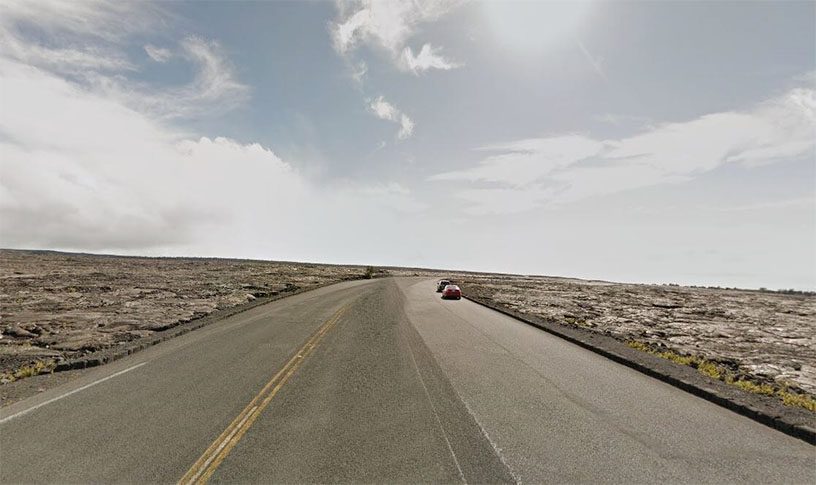
Volcanoes can dramatically alter landscapes, leaving lasting marks. Years after a lava flow on Hawaii’s Big Island, Google Earth captured its impact: a stark contrast of dark, hardened rock amid regrowth. Newer roads now skirt these cooled lava paths, navigating around what was once a lived-in area, revealing a history wiped clean and rebuilt.
Hawaii, essentially a massive volcano product of eons of eruptions, hosts landscapes shaped by these forces, creating both beauty and destruction. This particular lava surge ranked among the U.S.'s most financially damaging volcanic events, eradicating land, infrastructure, and fragments of everyday life in its relentless flow.
The Strange Circle Swirl in Egypt’s Desert Has a Surprisingly Human Explanation
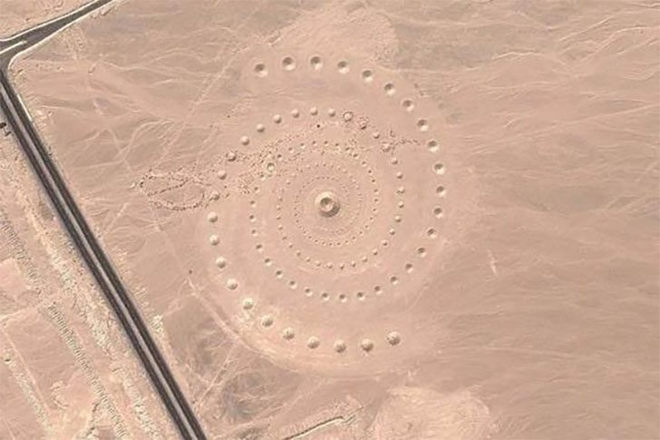
When travelers first spotted this eerie set of circles off a road in the Egyptian desert, many jumped straight to sci-fi. It looked like a crop circle’s sunbaked cousin, expected to be a message from afar. The real story is down-to-earth, and cooler. The pattern is a land art installation made by D.A.ST. Arteam, a Greek artist trio who designed the piece to be seen from above and experienced up close.
Stratou, one of the artists, explained that the desert wasn’t just a backdrop; it was the whole idea. "The desert, in our minds’ eye, was a place where one might feel eternity. We were talking about the desert as a mental condition, a mental landscape.” The work, known as Desert Breath, is still out there, slowly softening as wind and time blur its sharp edges, reminding that even big gestures eventually return to sand.
What’s That Dark Swirl on Google Earth? It’s a Buffalo Herd
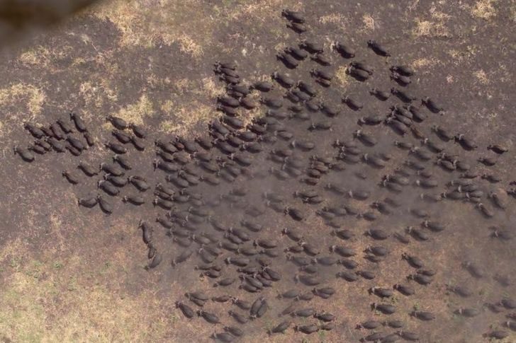
Zoom in on Tanzania’s Kigosi Game Reserve and you might spot something resembling a moving shadow. Get closer, and it clicks—a massive buffalo herd crossing the open plain. Kigosi teems with wildlife, including rare birds and animals, and offers safaris for those seeking the real-life experience. Yet, seeing satellite imagery capture such a vast gathering of big animals is a rarity.
African buffalo, tank-like creatures, share a size range with the more familiar American buffalo but carry a different vibe. Known for being unpredictable and dangerous, they account for numerous human injuries annually. Thus, a bird’s-eye view is appealing, offering the spectacle without the risk. Google Earth provides an exceptionally clear, safe vantage point.
The Oregon Cornfield “UFO” That Turned Out to Be a Giant Firefox Logo
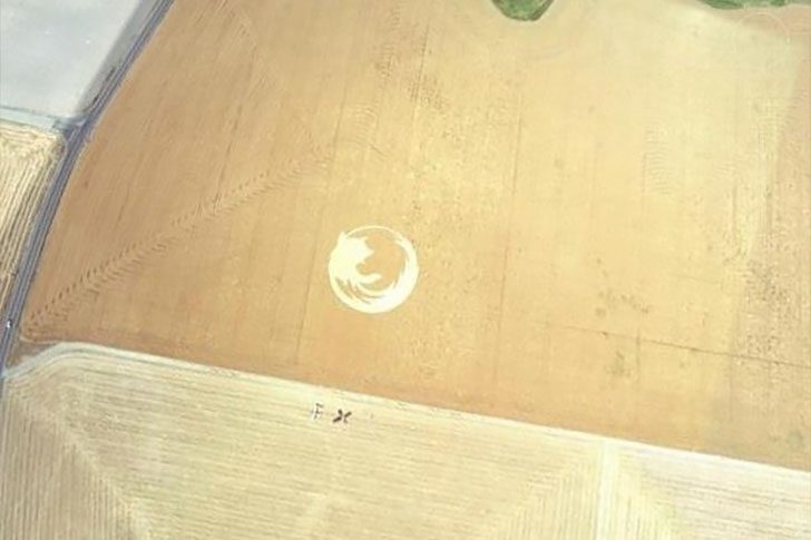
So, about that “alien message” in an Oregon cornfield, it’s a lot less mysterious than it looks. This crop circle wasn’t some intergalactic hello, it was a very enthusiastic shout-out to a web browser. Yes, Firefox. We get it, you’re fans. Still, branding the countryside is a bold choice. The whole thing popped up in 2006. A group of devoted supporters knocked it out in about 24 hours, like a one-day art heist, but with corn.
The giant stunt celebrated the browser hitting 50 million downloads. The Oregon State University Linux Users group crafted the massive logo, covering over 45,000 square feet and stretching roughly 220 feet across. From the road, it appears as a typical field. But from above, it snaps into focus, a crisp, unmistakable Firefox mark stamped into the landscape for anyone flying overhead to admire.
The One Pool So Huge It Looks Like a Second Ocean
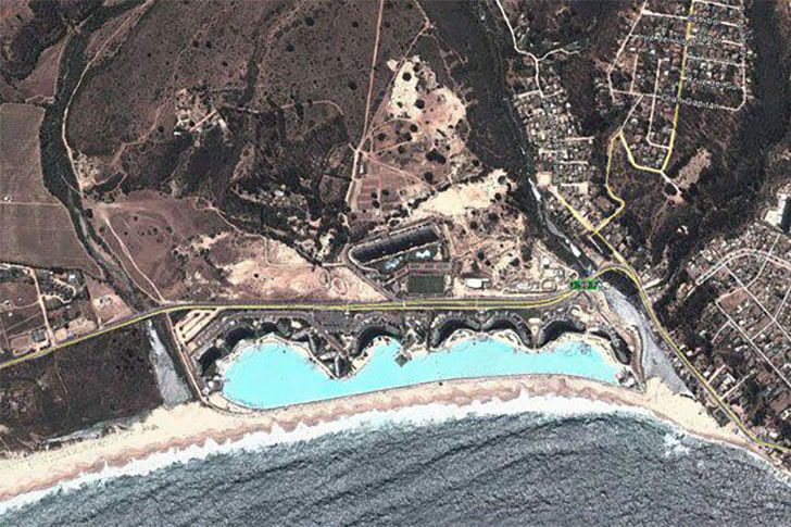
People exploring Google Earth off Chile have noticed what seems like an ocean twin. This extra body of water is actually a man-made pool at the San Alfonso del Mar resort in Algarrobo, Chile. It's a purpose-built mega pool, not an odd lagoon or optical illusion, and it holds the title for the largest swimming pool on the planet.
Spanning about 3,324 feet, it covers roughly 19.77 acres and can hold around 66 million gallons. If you love swimming, this spot is a bucket-list must. From above, it looks unreal, and in person, it's likely even more astonishing.
The “Island” That Fooled Maps for 100 Years
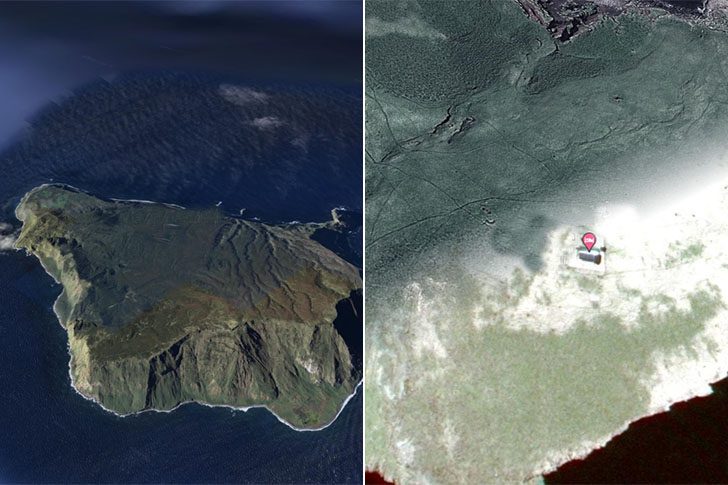
Fed up with noise and crowded streets? Imagine retreating to a remote island with peace and solitude. The South Pacific once promised just that—on maps, at least. In 2012, Australian researchers undiscovered a Manhattan-sized phantom island, revealing it was never real.
Google Earth displayed it as a strange black polygon, resembling a digital glitch. By April 2013, an obituary was published detailing how this nonexistent land persisted on navigation charts for over a century due to human mistake and possibly floating pumice.
The One Google Street View Snapshot That Makes You Flinch
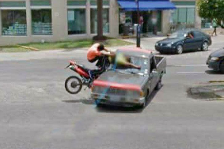
In Tlaquepaque, Mexico, back in 2015, a Google camera captured a split second nobody would want framed. A scooter rider clips a car and crashes, a wipeout you feel in your own knees just watching. Unlike awkward wedding photos, this moment is on Google Maps, so the whole internet can stumble across it.
The chaos escalates when two people on a motorbike slam into a pickup. One sprawls across the glass, the other floats mid-air like a paused action scene. Yet, bystanders barely react. People continue walking as if it's just another afternoon, adding to the surreal vibe, like the world forgot to panic.
Why This Tiny Green “Slow” Sign Might Be the Best Traffic Guard Ever
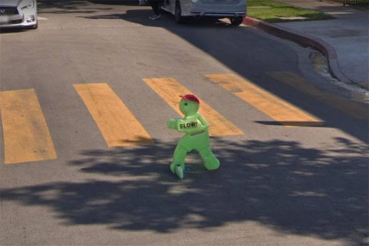
Plenty of us have daydreamed about having a fictional sidekick. If pulled over for speeding, the tiny green character seems like an improv genius who could talk you out of trouble. It feels weirdly more humane. I’m convinced people are less annoyed when the “enforcer” is an adorable alien-like figure instead of a person glaring.
At this point, do we want a human crossing guard telling us what to do? Give us the tiny green sign that says “slow,” clearly meant to stand in for a kid, and call it a day. It’s simple and hard to stay mad at something resembling a sci-fi cartoon character. Sure, you might still end up in jail, but that’s part of the thrill.
This Weird Jet on Google Maps Has People Doing a Double Take
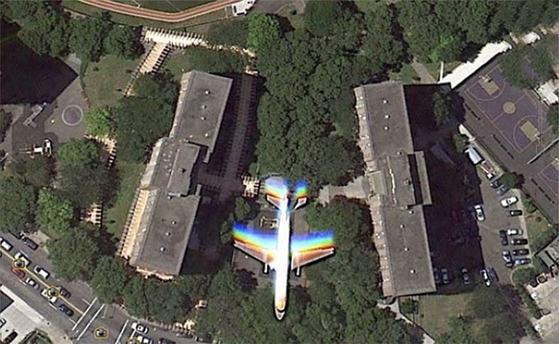
While Google’s satellites snapped the usual shots for Maps, they accidentally caught something more fun: a jet cruising through the frame. The result looks like a video game bug or a graphics card meltdown. Photographer Christoffer stumbled on the odd find around the Bushwick Houses and shared the surreal screenshot that makes the scene feel unreal.
You can spot the trippy aircraft on both Google Earth and Maps, with an official capture date of June 18, 2010. In a Google Earth zoom, the jet sits over trees, smeared into psychedelic streaks. The likely explanation is timing: the plane moved faster than the satellite camera’s shutter could freeze, resulting in an image stretched and color-shifted in a way that screams glitch, though it’s just physics.
He Checked Street View for Fun, Then Spotted the Maserati Hit-and-Run
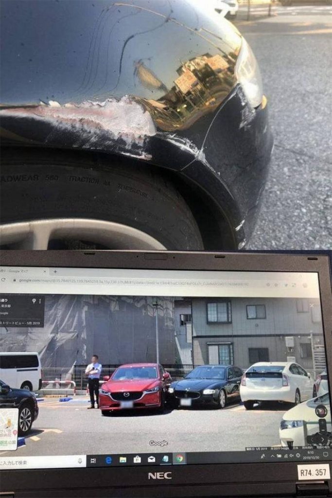
A Maserati Quattroporte took a nasty knock in a parking lot in Adachi, Tokyo. Google Street View captured it. Images show a red Mazda clipping the luxury sedan's front corner, leaving a clear scrape, then rolling off without an apology. The Maserati owner returned to find the car looking a lot less “Italian masterpiece” and more “body shop appointment.”
Expecting a normal commute, the Maserati owner found their car hit but with no explanation on the windshield. Paint transfer showed the other driver tagged the front end while pulling out and disappearing. Frustrated, they searched online and stumbled onto Street View footage capturing the Mazda contact and getaway.
The One Google Street View Snapshot That Turned a Lawn Mower Run Into a Time Capsule
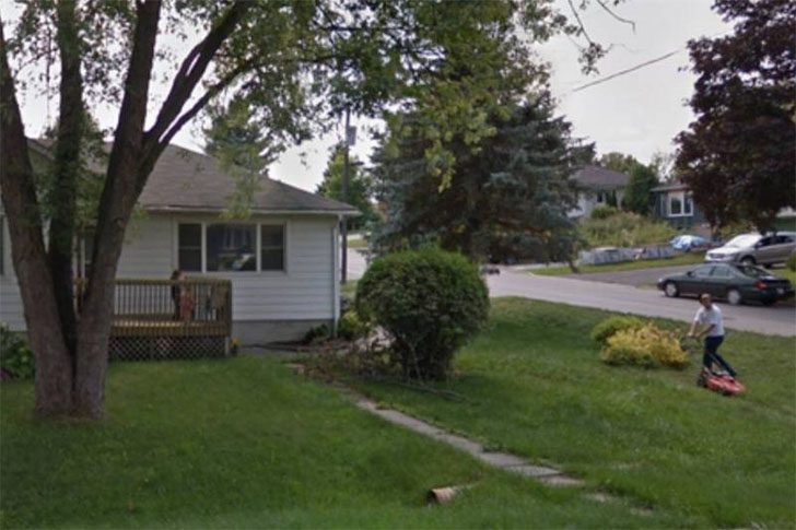
In the middle of a regular day, there he is, white shirt, black pants, standing by a strip of grass like it is just another chore. He is pushing a lawnmower, doing yard work nobody brags about but everybody has to do. The scene is simple and ordinary, the sort of thing you would walk past without a second thought. Just a guy outside, getting the lawn under control, with nothing about it screaming “special moment.”
The twist hits when you look closer. While checking out his place on Google Maps, he found a Street View photo of himself mowing right in front of his house. Instead of a driveway or a blurry car, there it was—a snapshot of his afternoon. Better yet, he had no clue his kids had come outside to watch him work. Suddenly it is not just yard duty, it is a little family scene, accidentally preserved online like a surprise scrapbook page.
The One Balcony Detail That Made Google Street View Hilarious
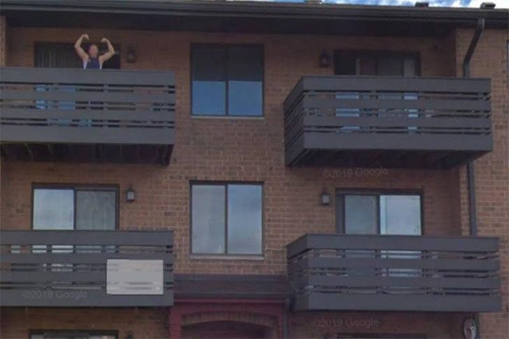
Street View captures candid moments with camera-equipped cars and staff on foot, aiming to document neighborhoods. The lens indiscriminately snaps whatever crosses its path, sometimes freezing mishaps for everyone to see. In this instance, an unsuspecting fellow looks like he just realized he was about to make an inadvertent online debut.
On a sunny day, an animated man in a blue shirt perches on his balcony, seemingly awaiting something grand. He reportedly exclaimed, “It’s here!” suggesting an anticipated arrival. The camera caught him vividly, allowing him to be discovered later while browsing Google Maps, still displayed for curious onlookers.
This Map Pinpoints Finland’s Public Saunas, and It’s Wildly Satisfying
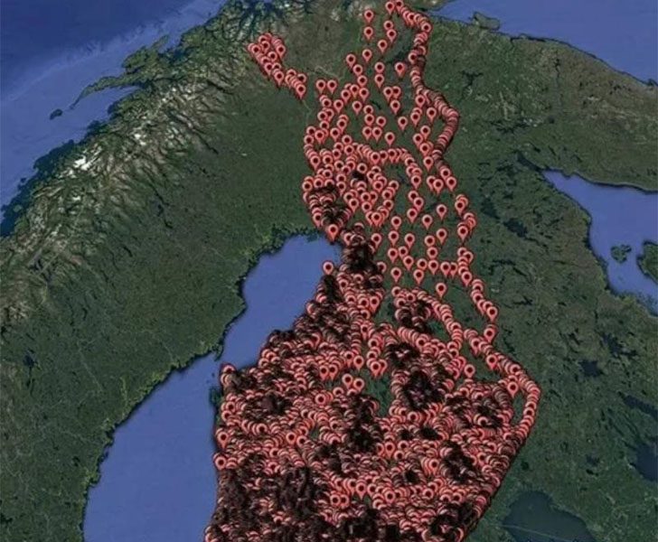
If you’re looking for another reason to visit Finland, consider this map filled with locations for public saunas. The country is already known for its natural beauty and quirky charm, but this feature adds an element of adventure. Start plotting stops and your itinerary practically writes itself. It’s practical, fun, and turns we should go someday into when are we going?
While saunas appear in many cultures, in Finland, they’re a way of life. Through harsh winters, they were essential for cleanliness and warmth. The tradition is so ingrained that some births have even occurred in saunas—not during a hot session, of course, but in clean, sanitary spaces. It’s quintessential Finland: practical, cozy, and a bit legendary.
What That Random Street View Camera Caught: Two Sword-Wielding “Samurais” in the Suburbs
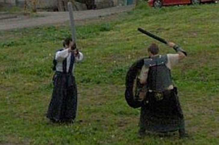
Hands down, one of the best Google Street View surprises ever is this: two total legends in armor, mid-duel, swinging swords like they’ve got a tournament to win. Maybe it's just hardcore reenactors living their best life, or two time-lost medieval warriors who took a wrong turn and decided to settle it on the pavement. Sadly, the Street View car rolled on before we got the ending, but the kilted fighters probably went all in.
Either way, respect is due. The timing is unreal, and the poses are so perfectly dramatic it feels staged, even if it was pure luck as the camera cruised by. We’ll never know who these guys are, or what started the showdown, but their commitment is unforgettable. If this was a neighborhood dispute, it’s the most stylish on record, and their suburban bravery deserves a slow clap.
Why Is There a Frying Pan on That Guy’s Face?
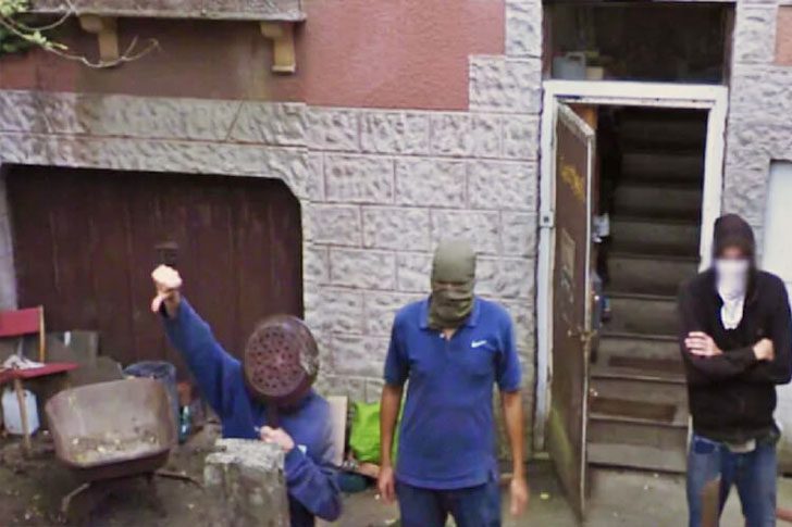
Google Earth often delivers stunning planetary views, but sometimes it captures bizarre images like this. Spot this group at night, and you'd cross the street. The standout detail: one individual with a frying pan on his face as if it’s protective gear.
Attempting toughness with cookware is a bold move. How did nobody say, “Hey, maybe lose the skillet if we’re going for scary”? The rest exude tough-guy vibes; he's more “just survived a kitchen fight.” It resembles a brawl's aftermath in Hell’s Kitchen, where the prize is a dented frying pan and a puzzled audience.
What Happened to Gumby in This Photo Will Make You Do a Double Take
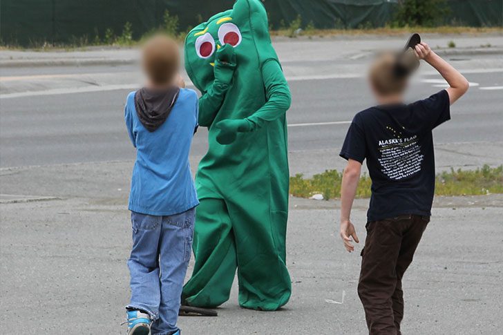
No location, just an uncanny image from a fever dream. There’s the green icon, getting manhandled by two determined kids. Wildly, he's bigger and in a suit, yet looks genuinely freaked out. It’s a snapshot of ruthless child antics. Bullying doesn’t discriminate, not even when the target is a cartoon legend.
It’s two against one, but these aren’t trained fighters. They're just kids, shifting the vibe. If things escalate, our character could probably handle them, theoretically. So he’s stuck with three options: make a run for it, endure the hits, or snap and retaliate. None sound ideal, which is the point.
The Dock Photo That Had Everyone Doing a Double Take
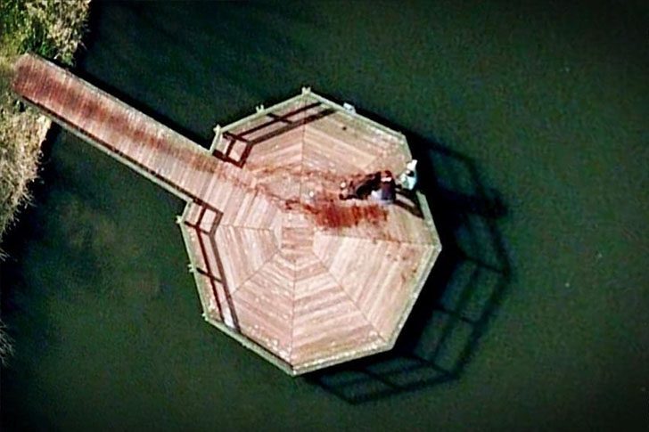
At first glance, this looks like a still from a grim Law and Order teaser. The coordinates point to a dock in a public park in the Netherlands, which only made people lean in harder. It seemed like a satellite had caught a body being dragged to the end of the pier and dumped, complete with what looked like a dark, crimson trail smeared across the boards. It was eerie and believable enough to spark a full-blown internet panic.
Then the web’s amateur detectives kept digging. The spooky “crime scene” turned out to be painfully normal. It was simply a couple and their dog taking a swim, then climbing back onto the dock and dripping all over the planks. That ominous “black blood trail” everyone was freaking out about was just water, plus shadows and a little bad luck with timing. The whole thing is a reminder that satellite photos can look dramatic, even when nothing dramatic is happening at all.
The One Google Street View Photo That Got Seriously Scary
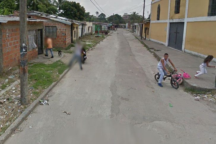
In this Street View grab, someone is standing outside a home, aiming a large gun straight at the Google car. The weapon was later blurred, but the vibe remains chilling. Only a few months before the image was captured, a 17-month-old child was found dead in what appears to be the same house. This makes the snapshot more unsettling, linking it to a place already tied to tragedy.
The image could do more than just spook people online; it might serve as evidence in a legal case. Street View operates by sending camera-equipped, Google-branded cars through neighborhoods worldwide. However, not everyone appreciates the rolling camera. In Villavicencio, Colombia, one resident reacted as hostilely as possible, clearly opposing the visit.
The Creepy Thing You Can Spot on Google Earth in Remote Russia
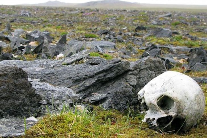
When scrolling feels like a full-time job, take a virtual detour. Pull up Google Earth, zoom in on Novaya Zemlya, and start poking around. You might spot what looks like a human skull sitting out in the open, making you wonder what happened there.
No official explanation exists for a skull in such an isolated spot, so theories multiply. This region draws attention because it hosted one of the USSR’s major nuclear testing areas, including the infamous Tsar Bomba detonation in 1961, the most powerful nuclear weapon ever set off. Keep exploring, but don’t be surprised if the “tour” gets unsettling fast.
Why Are There Finger Guns in This Google Street View Shot?
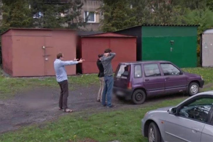
A Google Street View car captured a quirky “robbery” in progress. Two individuals stand with hands on their heads in a classic “don’t shoot” pose. Meanwhile, the supposed criminal is aiming finger guns, like he's in a low-budget action flick. As the car approaches, a vehicle and a few others in the background add to the scene's surreal vibe.
The robber seems to pull the pair out of their car, unfazed by the camera rig documenting everything. Perhaps he noticed but didn’t care, which is intriguing in itself. By the time the Google vehicle reaches the street's end, the situation slips out of view, leaving behind a moment that screams hold-up—yet with a pretend weapon. It's a spectacle that's both sketchy and amusingly absurd.
Why Are Some Google Local Guides Getting Holiday Socks in the Mail?
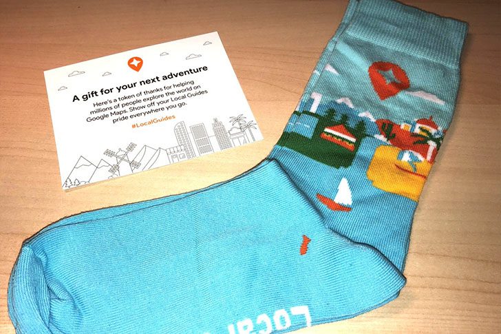
Local Guides quietly enhance Google Maps by building lists, adding tips, and pointing visitors to local points of interest. As a thank you, Google occasionally offers perks for these contributions. Recently, the company has been spreading holiday cheer with a simple yet delightful gesture. Some Guides report receiving socks, a small “we see you” gift for their mapping efforts.
Posts on Twitter and Reddit indicate the giveaway's reality, with socks featuring landmark graphics and the Local Guides name. Described as “a gift for your next journey,” it suggests, “Thanks for all the reviews, now go explore.” It appears to be a selective rather than universal reward, but free travel-themed socks are hard to dislike.